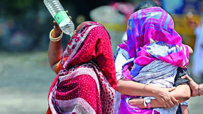

NEW DELHI: Delhiites lay exposed to lethal levels of heat stress both during the day and night Sunday as the ‘feels like’ temperature stayed above 50 degrees C while night temperature surged to the highest recorded in June in two years.A heatwave added to the woes. Day temperatures at Safdarjung, Delhi’s base station, topped at 41.8 degrees C, 4.6 notches above normal, as compared to 41.3 degrees C a day earlier. This was the first heatwave day at Safdarjung in the last 40 days and the third this summer, while some other parts of Delhi have seen more. Lodhi Road was hotter at 42.1 degrees C.What made conditions unbearably oppressive was high humidity, which ranged from 37% to 70%. This raised the heat index, or ‘feels-like’ temperature to 50.7 degrees C at 5.30pm on Sunday, just a notch below 51.3 degrees C recorded at 2.30pm a day earlier. Prolonged exposure to such levels of heat increases the risk of severe heat exhaustion and other potentially life-threatening conditions.Night provided no respite as the minimum temperature at Safdarjung settled at 31.1 degrees C, three notches above normal and the highest for the month since June 19, 2024, when it touched 35.2 degrees C.Heat stress has built up over the past few days in the absence of monsoon rains. Saturday (June 27) was the normal date of its arrival in the capital. While the city may get some rain over the next few days, monsoon isn’t expected till at least June 2.Yellow alert in place for rain, thunderstorm over next 2 daysWhile the met department issued a yellow alert for rain, thunderstorm and gusty winds for Sunday night, temperatures may start dipping only from Tuesday and may fall to 35 degrees C by July 3.A heatwave was declared on Sunday as it met the criteria of the maximum temperature being over 40 degrees Celsius and more than 4.5 degrees above normal.“Heat wave conditions occurred at a few places over Delhi. A further rise in maximum temperature is likely by 1-2 degrees Celsius during the next 24 hours but a gradual fall by 5-6 degrees Celsius is expected during the subsequent four days,” a met official said.IMD has predicted that the maximum temperature is likely to remain between 40 and 42 degrees C on Monday with chances of rain and thunderstorm. However, a yellow alert is in place for rain, thunderstorm and gusty winds for Tuesday and Wednesday. The maximum temperature is likely to dip below 40 degrees Celsius by July 1 and may dip further to 35 degrees Celsius by July 3.Despite night temperature staying above 31 degrees C, the city did not meet ‘warm night’ conditions on Sunday. The met department considers a ‘warm night’ when the maximum temperature is over 40 degrees C and the minimum is at least 4.5 degrees C or more above normal.The minimum temperature on Saturday was 30.8 degrees C. The season’s highest minimum of 32.4 degrees C was recorded on May 25. It is likely to stay around 29-31 degrees Celsius on Monday and may drop to around 22-24 degrees Celsius by July 3.The city’s AQI, meanwhile, stayed in the moderate category at 152.