
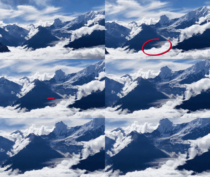
A Chinese photographer accidentally captured the moment a massive ice-rock avalanche struck Mount Langtang Lirung in Nepal during a drone shoot on August 26. This has offered researchers new clues about the disaster that triggered a deadly chain of floods and landslides in the Himalayas.The footage, recorded from a mountaintop radar station in China, shows a white mass suddenly cascading down the mountain, followed by a huge brown dust cloud rising from the Lhende Khola Valley, according to a report by Nepal Times.According to the analysis, the disaster appears to have been caused not simply by a glacier collapse but by the failure of the mountain’s rock face beneath a hanging glacier. A massive combination of rock and ice then plunged about 1,500 metres down the north face before crashing onto the glacier below.The impact triggered a 5.2-magnitude tremor and sent a torrent of debris and water into the river system. The resulting mudflow reportedly reached the Chinese customs and immigration building in Gyirong within about 20 minutes before travelling downstream towards the Trisuli valley.Scientists are studying the newly emerged footage to better understand what triggered the collapse and identify similar risks elsewhere in the Himalayas. Researchers have pointed to the region’s fragile geology and warming temperatures, which can thaw permafrost that helps bind mountain rock together.The footage has emerged as Nepal continues rescue and rehabilitation efforts following the wider disaster.The death toll climbed to 903 on Monday, according to the National Disaster Risk Reduction and Management Authority (NDRRMA), while around 4,247 people remain missing. So far, 10,451 people have been rescued.