")
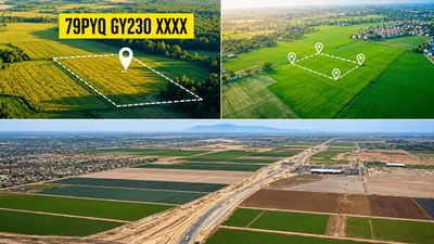
Buying land means going through several documents, such as ownership papers, survey maps and revenue records, to confirm its details. These steps are crucial to minimise chances of any disputes afterwards. To make the process easier, government is rolling out Bhu-Aadhaar, a 14-digit Unique Land Parcel Identification Number (ULPIN) that gives every piece of land a unique digital identity, based on its location.The move is aimed at simplifying property verification by creating a standard digital record for each plot. This could help buyers, banks and government agencies access accurate land information more easily and reduce the chances of confusion or disputes.According to the department of land resources, ULPIN is a single, authoritative source of truth for information on any parcel of land or property to provide integrated land services to the citizens as well as all stakeholders.How is ULPIN generated?The ULPIN system is based on an international standard which complies with Electronic Commerce Code Management Association (ECCMA) standard and Open Geospatial Consortium (OGC) standard.The 14-digit ULPIN is generated using a computational formula based on the geo-referenced coordinates of a land parcel’s boundary points. According to the department of land resources, the system assigns an ECCMA standard-compliant unique identifier, known as a Property Natural Identifier Unit (PNIU).The identifier is derived from the parcel’s latitude and longitude coordinates, referred to as the Property Natural Identifier Lot (PNIL). Because the number is generated from the plot’s geo-referenced boundaries, the ULPIN remains linked to the physical location of the land.In simple terms, the unique number is not assigned randomly but generated from the land parcel’s mapped geographic coordinates, giving each plot a distinct digital identity tied to its exact location.Benefits of ULPIN:For property owners and buyers, ULPIN could simplify real estate transactions by linking key information such as ownership details, plot size and geographical coordinates to a single identifier. The system will help to address the property taxation issues and support more accurate land administration.ULPIN is expected to strengthen land statistics and accounting, aiding the development of land banks and contributing to the creation of an Integrated Land Information Management System (ILIMS). It will potentially help in disaster planning and response, as geo-referenced land data can help improve decision-making during emergencies.According to the department, the system could also support the implementation of welfare schemes linked to land ownership, help reduce boundary disputes and advance the objectives of the government’s Geospatial Policy 2022.What Bhu-Aadhaar means for buyersThe rollout of ULPIN has already gained significant ground across the country. According to the land resources department, the system has been rolled out in 29 states and Union Territories, including Andhra Pradesh, Bihar, Gujarat, Maharashtra, Rajasthan, Uttar Pradesh, Karnataka, Tamil Nadu, Kerala and the National Capital Territory of Delhi.Pilot testing of ULPIN has also been conducted in four States and Union Territories including Puducherry, Telangana, Manipur and the Andaman & Nicobar Islands.Some states and Union Territories, including Madhya Pradesh, Ladakh and Jammu & Kashmir, are also using ULPIN under the SVAMITVA (Survey of Villages and Mapping with Improvised Technology in Village Areas) scheme to create and maintain digital property records in rural areas.As the government moves towards a more digital land governance system, Bhu-Aadhaar could become an important tool for standardising and modernising land records.As the rollout expands across the country, the government expects the system to facilitate property transactions, strengthen land administration and contribute towards an Integrated Land Information Management System.